If you're a bit confused, take a look at the map below.
What you're seeing is the end result of geospatial technology, a relatively modern use of accumulated data. It's the process of gathering information and placing it on the Earth's surface with the intent to make qualified decisions, like where the best place to build a new neighborhood sits or where there may be a need for a new fire station.
After designating the Zombie Apocalypse as the platform--if you haven't heard, zombies are a big deal these days in the teen scene, just check out MTV--students divided into two groups, committed to either finding safe places for victims of the Zombies or identifying prime places for Zombies to attack. Students developed criteria for both sides. Did you know zombies can't swim? As CACC junior Shelby Richardson exclaimed, "Oh, absolutely not. If you're near water, you're good." Or that they are not so great at climbing? They also used their common sense, like where can you easily find arms to defend yourself against a zombie, and where military bases are located for protection.
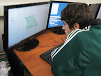
Each student was assigned a criterion, developed a database of applicable coordinates, and then used geospatial technology to plot the information on the map. For some, the process was a simple task, but for others, it was tough to compile the data. CACC junior Andrew Bare compiled the list of arms retailers throughout the state. "It was tough to find all of the pawn shops, Wal-Marts, Bass Pros, and others," he noted with a smile, "but now we know where to run if the zombies come after us."
"This was a great way for the students to really get energized and engaged about geospatial technology," said Estabrooks, "Now that they've learned how to use the equipment and technology with this project, we can really do some cool things this year."
An upcoming project Estabrooks has planned includes analyzing data from the Black Bear Project funded by the University of Mississippi.
Check back later for an update and more geospatial technology!
After designating the Zombie Apocalypse as the platform--if you haven't heard, zombies are a big deal these days in the teen scene, just check out MTV--students divided into two groups, committed to either finding safe places for victims of the Zombies or identifying prime places for Zombies to attack. Students developed criteria for both sides. Did you know zombies can't swim? As CACC junior Shelby Richardson exclaimed, "Oh, absolutely not. If you're near water, you're good." Or that they are not so great at climbing? They also used their common sense, like where can you easily find arms to defend yourself against a zombie, and where military bases are located for protection.
Each student was assigned a criterion, developed a database of applicable coordinates, and then used geospatial technology to plot the information on the map. For some, the process was a simple task, but for others, it was tough to compile the data. CACC junior Andrew Bare compiled the list of arms retailers throughout the state. "It was tough to find all of the pawn shops, Wal-Marts, Bass Pros, and others," he noted with a smile, "but now we know where to run if the zombies come after us."
 |
| CACC Senior Brandon Braumstedt |
 |
| CACC Sophomore Blake Hausman |
"This was a great way for the students to really get energized and engaged about geospatial technology," said Estabrooks, "Now that they've learned how to use the equipment and technology with this project, we can really do some cool things this year."
An upcoming project Estabrooks has planned includes analyzing data from the Black Bear Project funded by the University of Mississippi.
Check back later for an update and more geospatial technology!


